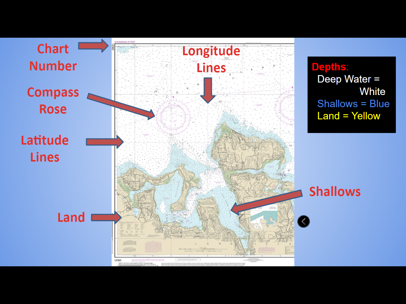
Charts and Navigation
- Nautical Charts
- maps that show the makeup of the shoreline and seafloor
- provide water depths
- show locations of navigation dangers
- plot physical location to help navigation
- display anchorages
- Charts include:
- Chart number
- Latitude/Longitude
- Depths
- Hazards
- Buoys
- Distances
- Compass Rose
- Magnetic vs True North
- Latitude and Longitude: The Imaginary Lines
- Latitude
- horizontal lines, parallel to equator
- denotes N and S position
- Longitude
- vertical lines, perpendicular to equator
- denotes E and W position
- Measured in degrees, minutes, seconds, direction
- Locust Valley High School
- 40o 53' 16" N, 73o 35' 31" W
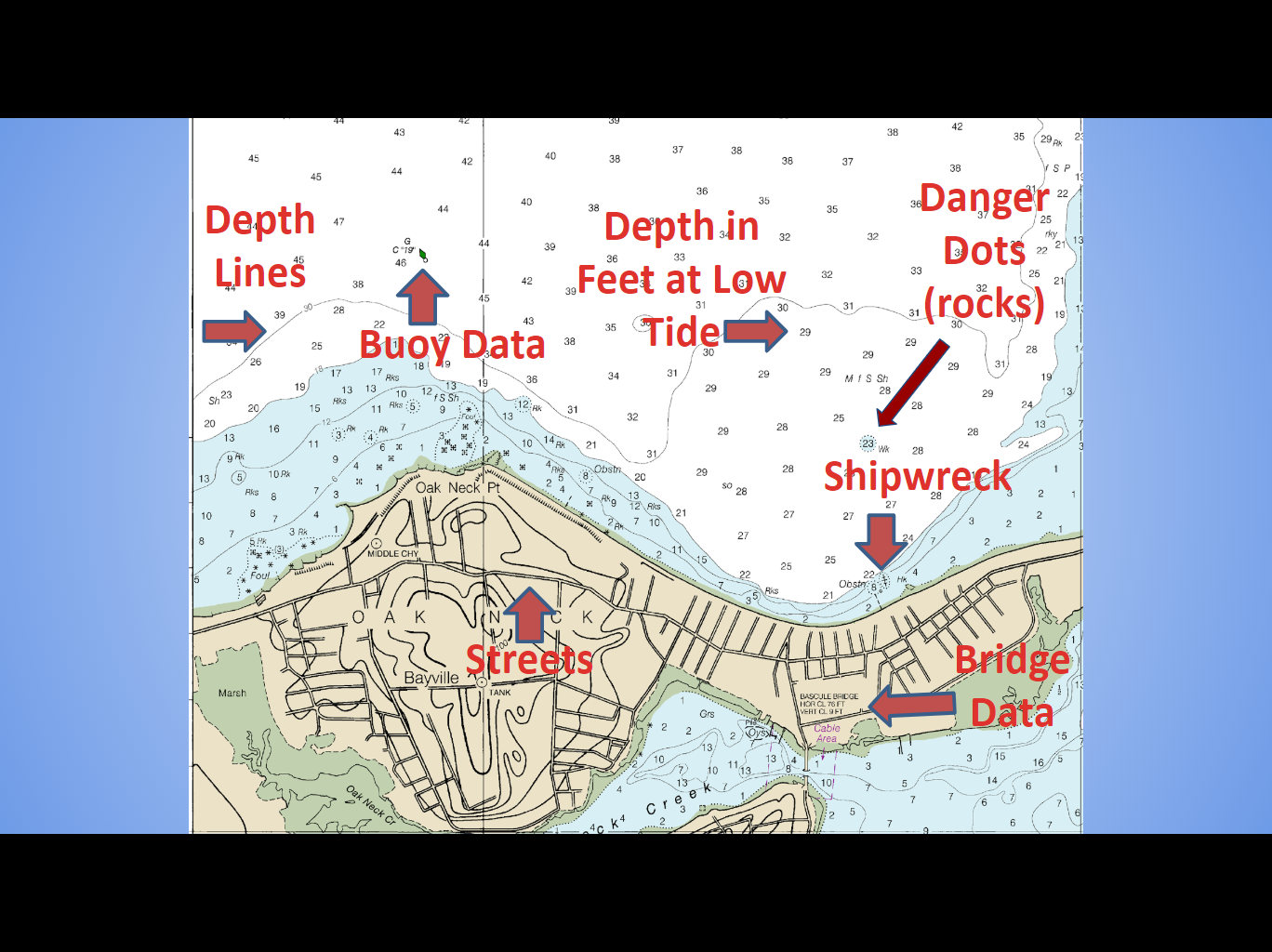
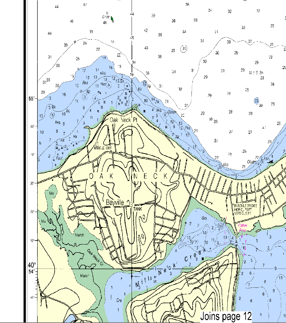
- Depths
- Represented by the numbers on the chart (in feet)
- Uses the average height of the lowest tide recorded at a tide station during the recording period
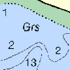
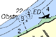
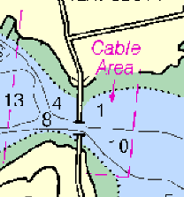
- Bottom features and hazards
|
|
||
Marsh (Mar) |
Rocks (Rks) |
Grass (Grs) |
Mud and Shells (M Sh) |
|
|
|
|
Shipwrecks |
Cable Area |
Submerged Pilings (poles) |
|


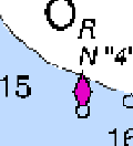
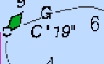
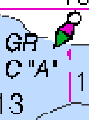
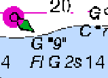
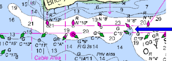
- Buoys
- Anchored floats serving as navigation markers
- Numbers on buoys increase as you come closer to port
- Some flash, some make sound
- Green buoys
- "cans"
- odd numbers
- Red buoys
- "nuns"
- even numbers
- As you return, keep the reds on the right.
- As you leave, the reds are on your left.
|
|
|
R N "4" Red "Nun" #4 |
G C "19" Green "Can" #19 |
|
|
|
|
GR C "A" Red/Green Mid-Channel |
G "9" Fl G 2s Lighted: #9, Flashes (Fl) Green (G) every 2s |
|
- Passing a boat
- Just like keeping red on the right when returning from sea…
- When passing a boat, keep its red light on the right of your view.
- Numerical Data
- 1 nautical mile = 1 minute of latitude
- Speed is measured in knots (kn)
- 1 knot is 1 minute of latitude per hour
- Compass Rose
- A circle divided into 360° numbered clockwise from true or magnetic north, printed on a chart to help determine the course of a vessel
- True north (North Pole) values are the outer ring
- Magnetic north values are the inner ring
- The variation information is contained in the compass rose closest to the ship's DR position
- DR = "Dead Reckoning"
- position calculated using a previous position (or "fix"), advancing position by estimated speed, times, course
- True bearing = Magnetic bearing + Variation
- add east variation or subtract west variation
- Tools of the Trade: Dividers
- Use dividers and latitude to measure nautical miles
- Determine distance
- Set the distance between prongs to one minute latitude
- "Walk" the divider from start position to end position
- "Pinch" to measure excess
- Tools of the Trade: Parallel Ruler
- Determine direction
- “The Walking Method”
- Line up points A to B
- Walk ruler up to compass rose
- Tools of the Trade: Sextant
- Used to measure angle between celestial object and horizon
- "Sighting" or "shooting" the object
- Can be used to estimate latitude (against sun) or longitude (against moon)
- Excellent precision
Project
Make a Map
Using standard NOAA coloring and abbreviations, create a map of a fictional area of your design. Include details like low tide depths, obstructions, land, streets, and an island. Maps may be hand- or computer-drawn.